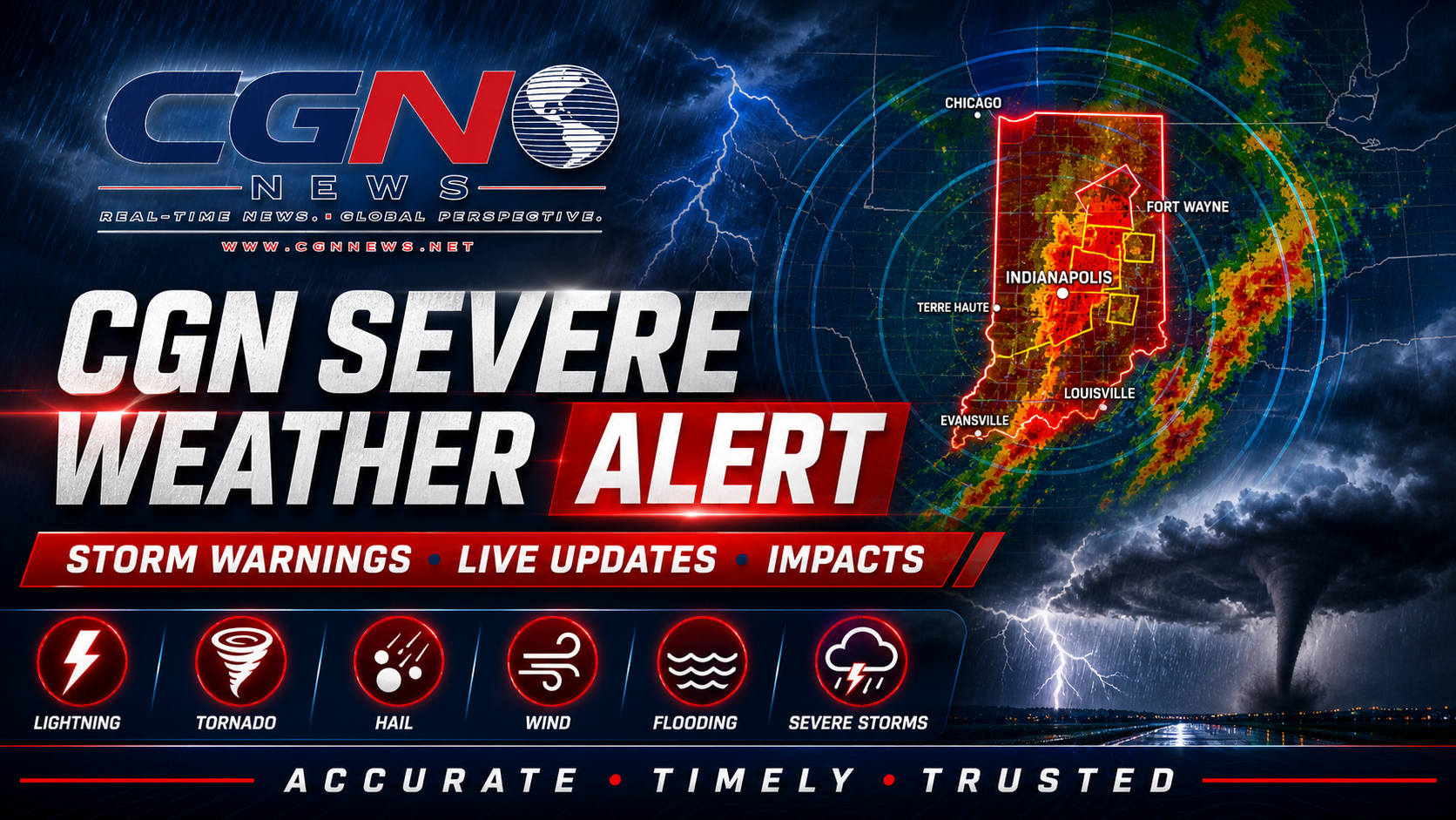
INDIANAPOLIS | A powerful early-summer storm system is crossing the Midwest on Wednesday, bringing a threat of severe thunderstorms, damaging winds, large hail, tornadoes and flash flooding to central Indiana, northern Illinois and northwest Indiana.
The National Weather Service in Indianapolis said multiple rounds of thunderstorms could affect central Indiana, with the more dangerous period expected during the afternoon and evening. Storms may strengthen quickly in warm, humid air, and some could produce damaging straight-line winds, large hail and tornadoes.
Central Indiana faces multiple rounds of storms
The first round may affect parts of central Indiana during the afternoon, followed by a broader round later in the day and into the evening. Indianapolis, its surrounding counties and communities farther north should remain weather-aware even during temporary breaks in rain.
Strong winds outside thunderstorms may also create travel and property hazards. Residents should secure patio furniture, trash containers and other loose outdoor objects before storms arrive. Drivers of trucks, buses and other high-profile vehicles should be prepared for sudden crosswinds.
Chicago region faces a significant severe-weather threat
The National Weather Service in Chicago warned of severe thunderstorms across northern Illinois and northwest Indiana. The strongest storms could produce destructive winds, large hail and tornadoes, while repeated downpours may cause flash flooding in urban and low-lying areas.
Recent heavy rain has left parts of the region more vulnerable to runoff. Streets, underpasses and drainage systems may flood quickly if storms repeatedly move over the same communities. Motorists should never drive through water covering a road because the depth and condition of the pavement may be impossible to judge.
Travel may become dangerous quickly
Conditions along Interstate 65 between Indianapolis and Chicago may change rapidly. Heavy rain can reduce visibility to near zero, while strong winds and hail can make highway travel hazardous. Drivers should slow down, increase following distance and leave the road safely if conditions become too dangerous.
Air travelers should also prepare for possible delays at Indianapolis International Airport, Chicago O'Hare International Airport and Chicago Midway International Airport. Thunderstorms can interrupt ground operations and force aircraft to reroute around dangerous cells.
Know where to shelter
Before storms arrive, identify the lowest interior room of a sturdy building, away from windows. A basement is best when available. People in mobile homes should arrange access to a substantial building before a warning is issued because mobile homes provide little protection from tornadoes or destructive winds.
Keep wireless emergency alerts enabled and use more than one way to receive warnings. Outdoor sirens are designed mainly for people who are outside and may not be heard indoors. A NOAA Weather Radio, local alert service or trusted weather application can provide additional warning.
Flooding is a separate life-safety threat
Heavy rain can be dangerous even where wind and hail remain limited. Water may rise rapidly on neighborhood streets, near creeks and in poor-drainage areas. Turn around rather than attempting to cross a flooded road, and keep children away from fast-moving water.
Businesses, schools, construction crews and outdoor event organizers should review shelter and communication plans. Workers should know who has authority to stop outdoor activity and where people can move quickly if a warning is issued.
Conditions should improve after the front passes
Weather should gradually improve after the main storm system moves east, although scattered showers, gusty winds and localized flooding may linger. Forecast details can change quickly on a severe-weather day, so readers should rely on current county-specific watches and warnings from the National Weather Service.
Additional Reporting By: National Weather Service Indianapolis; National Weather Service Chicago; NOAA Storm Prediction Center; NOAA.