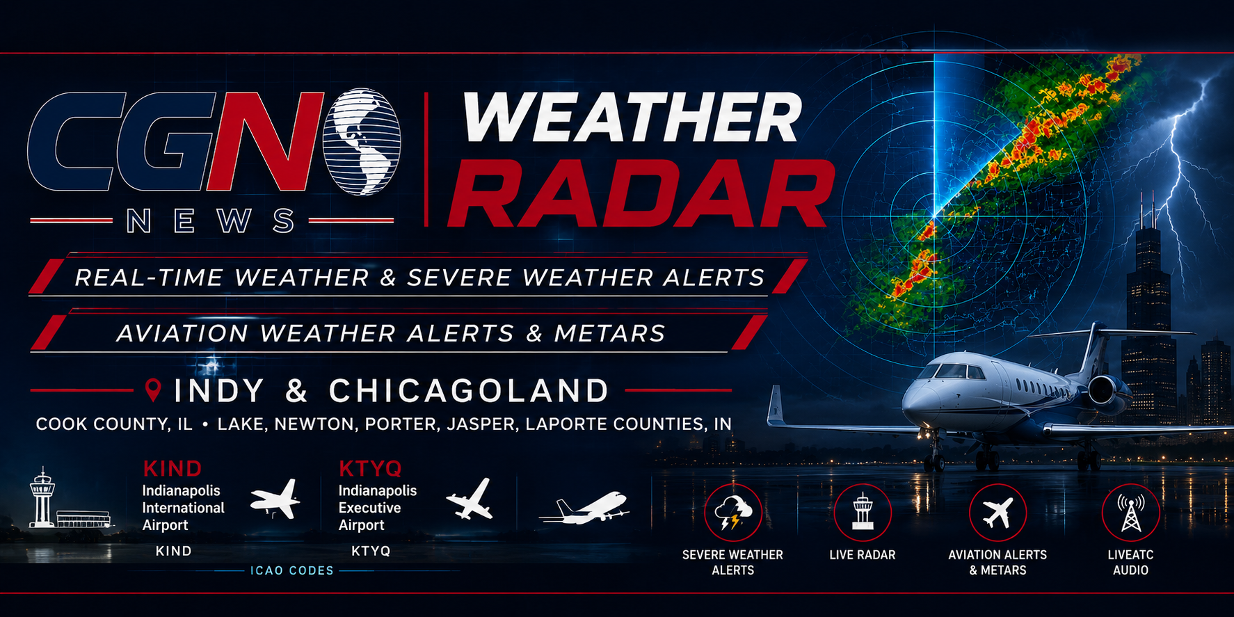
CGN Weather Radar
Official-source radar and active National Weather Service alerts for CGN U.S. radar cities, with dedicated pages for Indianapolis, Valparaiso, Chicago, St. Louis, Kansas City, Springfield, Tecumseh and the full U.S. Weekly Weather Brief city roster.
Live Aviation Audio
Select an Indianapolis, Chicagoland, or Northwest Indiana airport. CGN links to the official LiveATC airport page and does not scrape or hotlink undocumented raw audio streams.
KIND — Indianapolis International Airport
Open the official LiveATC airport page to listen to tower, ground, approach, departure, ATIS, or available sector feeds. Availability varies by airport and feed status.
Live aviation audio is provided by LiveATC.net. Feed availability, coverage, delay, player access, and audio quality are controlled by LiveATC and its volunteer feeder network. CGN News does not own or control LiveATC feeds.
AIRMETs, SIGMETs & Aviation Weather Sources
CGN Weather Radar links readers to official NWS Aviation Weather Center products for aviation advisories, warnings, and observations.
About CGN Weather Radar
CGN Weather Radar is a reader-service tool for checking radar, National Weather Service alerts, aviation weather observations, and official source links for Indianapolis and Chicagoland.
National Weather Service and NOAA remain the official sources for watches, warnings, advisories, emergency weather information, and forecast office guidance.
Important Safety Note
Radar, aviation observations, and third-party audio links may be delayed, unavailable, blocked by a provider, affected by maintenance, or limited by browser/network restrictions.
During severe weather, follow warnings, instructions, and emergency information from the National Weather Service, NOAA, local emergency management, and public safety officials.
Sources and attributions: Radar and alerts are provided by NOAA / National Weather Service services where available. Base map tiles © OpenStreetMap contributors. Leaflet map library is used for the interactive map. Live aviation audio links point to LiveATC.net official pages. METAR observations are requested from National Weather Service / Aviation Weather sources where browser access permits.